Last month, heavy rains in north India triggered flash floods and landslides. The mountain state of Himachal Pradesh was badly hit by the disaster.
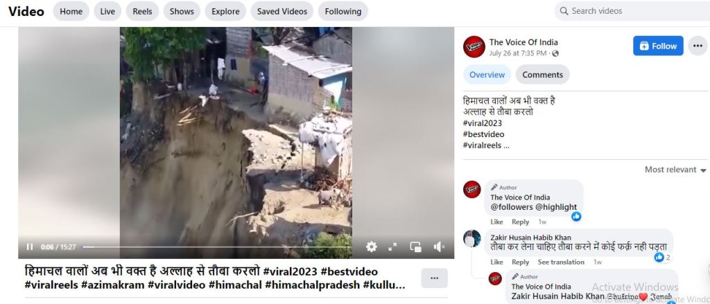
In this context, social media users circulated a video depicting a flooded river eroding its banks, causing mudslides. The Facebook page “Voice of India” accompanied the video with the caption, “People of Himachal Pradesh, there’s still time. Pray to Allah.”
Contrary to these claims, the video is unrelated to the floods in Himachal Pradesh. It instead portrays a flooded river in Duhabi, a small town in Koshi Province in southeastern Nepal.
We employed various tools, including Google Earth and Google Maps, to pinpoint the video’s location.
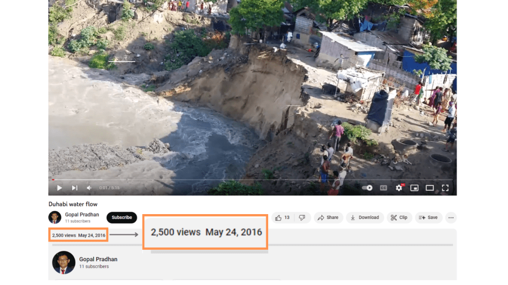
The video, uploaded by YouTube user Gopal Pradhan on May 26, 2016, runs for five minutes and 15 seconds. It clearly identifies the location as Duhabi, a small town in the Koshi province of eastern Nepal. Leveraging this key clue, we cross-referenced the video with Google Earth for precise geolocation.
Furthermore, the video contained auditory and linguistic cues, such as sounds and conversations in the Nepali language. Relying on the clue from the video, we searched for similar locations near Duhabi using Google Earth.
The initial segment displays a mound that appears to have collapsed during the Budi Khola flood in Duhabi. Subsequently, a sequence unfolds, illustrating successive erosion. A pig can also be seen roaming amidst the devastation, followed by the toppling of a tree. The camera captures people observing from the riverbank, encompassing the surrounding scene, including the presence of women. The sound of a whistle punctuates the scene.
A man says, “The police are arriving to evacuate the area.” Shortly thereafter, police personnel arrive on the scene, accompanied by the blaring of a horn. Concurrently, people gather on a bridge, observing the flooded river as it continues to erode the banks. Additional footage documents the extent of the destruction. The camera then provides a wider view, with an individual heard exclaiming, “You must upload this video.” Another voice predicts, “This section is on the verge of collapse.” Before long, both a mound and a tree succumb to the river’s force, being swept away. Bystanders witness the calamity as erosion persists, while efforts to divert the river are underway. The sound of an ambulance adds to the backdrop.
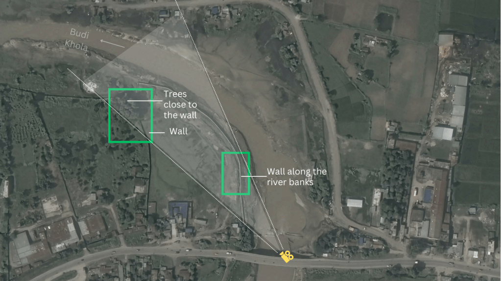
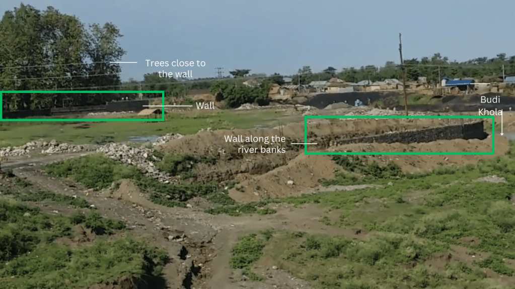
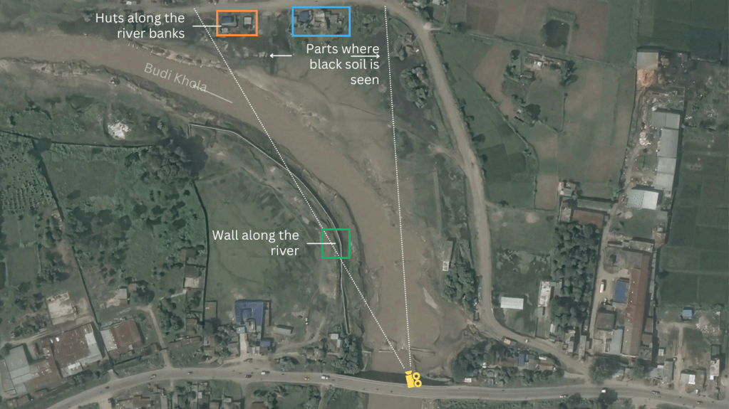
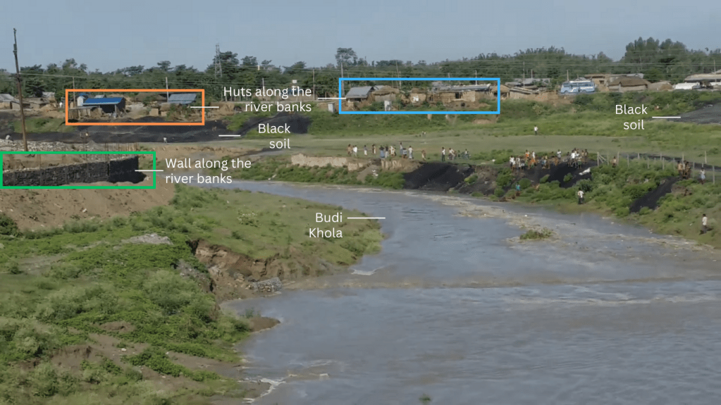
Below are screenshot comparison of the viral video and the Google Earth images.


Despite insights from the video, pinpointing the river and settlement remained challenging. We utilized Google Earth to juxtapose imagery with the viral video’s scenes. Notably, black soil imagery on Google Earth corroborated the match, and a bridge was also identified. This evidence confirms the Budi Khola River’s flood, causing settlement damage.
Utilizing Google Earth’s Historical Satellite Imagery, we corroborated the event’s 2016 occurrence. A comparison with 2014 imagery, devoid of flood-related damage, further supported our findings. Imagery from October 2016 showed the settlement’s deterioration.
To further corroborate it, Nepal Check spoke with Suman Puri, a Duhabi-based reporter with Nepal Khabar. The river had flooded in 2016, according to him. We couldn’t find any local media reports of the event.
Based on this collective evidence, we have concluded that the claim that the video showed recent floods in Himachal Pradesh, India, is misleading.
| Claim | Claimed by | Nepal Check Verdict |
| Video shows a flooded river in Himachal Pradesh of India | Social media users | Misleading |

You must be logged in to post a comment.